
A cool, wet winter and suddenly — 90 degrees in Tucson. Maybe it’s time for a change in elevation.
The mountains near Tucson offer new recreation ventures for short day trips — thanks to federal recreation funds, proactive staff, and more paid and volunteer trail crews.
“If you live in Tucson, out your back door you have a national forest that’s much larger than Grand Canyon National Park,” said Adam Milnor, recreation staff officer for the Coronado National Forest headquartered in Tucson.
“The Coronado has 1.68 million acres over 15 mountain ranges; people come from all over the world to see these places,” Milnor said. “You have the ability within a two- to three-hour drive to see much of the Sky Islands, a really unique part of the Southwest.”
The nearby Rincons (mostly administered by the National Park Service as Saguaro National Park) and the Santa Catalinas on the Coronado Forest “are like the single of an album played on the radio,” Milnor said. “You should enjoy the whole album.”
People are also reading…
From Milnor and helpful staff on five ranger districts, some recreation offerings are listed below, one to three hours’ drive from Tucson. Using Google Maps, driving distances and times were measured from the center of metropolitan Tucson, which according to a 2019 Star article, is Steward Observatory on the University of Arizona campus.
Refurbished trails, visitor centers and cabins are described below, starting with the closest areas to Tucson and moving outwards, focusing on higher elevation options. Hiking trails and driving directions to trailheads are on the Coronado National Forest’s hiking page at tinyurl.com/cnfhike.
The 2020 Great American Outdoors Act, which supports recreation infrastructure in national parks and forests, has provided major support for new recreation venues on the Coronado; some $5.14 million in 2021, $1.27 million in 2022 and $2.4 million in 2023, Milnor said. The forest also has obtained other grants and increased partnership ability through the agency’s 10-year Trail Stewardship Challenge program. The number of volunteers and partners involved in projects is mind-boggling, and only a few key players are mentioned here.

Santa Catalinas
Drive time: 30 to 45 minutes; Marshall Gulch 1 hour, 20 minutes
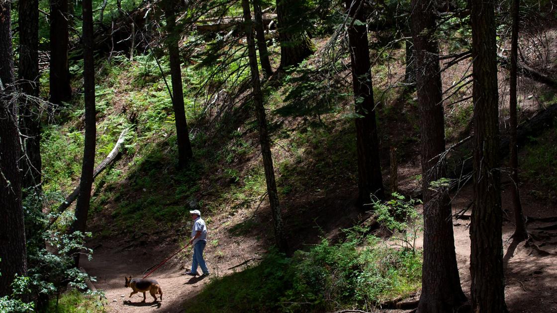
Popular Sabino Canyon roads in the Santa Catalinas were repaved last year (available for shuttle-free walking and cycling before 9 a.m. and after 4 p.m.). Sabino Visitor Guide and other maps are available at the visitor center, open 9 a.m. to 4 p.m.
New or rebuilt trails are the most tangible improvements in the Santa Catalina Ranger District. The new .2-mile Upper Tanque Verde Falls trail offers access to the falls. For longer hikes, Romero Canyon Trail, trashed by the Bighorn Fire of 2020, has been rebuilt beyond the popular Romero Pools. It’s a mostly steep 7.5-mile climb to Romero Pass from Catalina State Park trailhead. (A shady camp on Romero Creek at just over five miles is a good goal for a shorter hike.)
Also recently rebuilt are the first few miles of Palisades Trail, a 12.5-mile one-way hike from Gordon Hirabayashi trailhead to Palisades Ranger Station at 7,000 feet (this includes a 2.5-mile section of the Arizona Trail). For the one-way hike, do a “car switch” and leave one vehicle near Palisades. A 10-mile out-and-back will reach a panoramic view of the front range.
Start early to hike these trails, which begin at low elevations.
An assortment of volunteers and paid crews have helped brush and open trails, said acting Santa Catalina district recreation staff officer Timothy “Jake” Baechle. ArizonaWild, a nonprofit, and Student Conservation Association crews did Romero brushing and trail rerouting; ArizonaWild rebuilt and removed vegetation on Palisades Trail. Besides paid crews, 20 volunteer groups help keep trails open. The district hired two seasonal trail technicians for six-month stints in 2021 and 2022; another four will be hired this year. They work on harder-to-reach projects and team up with partner groups to cut down trees, rebuild tread, install rock structures and scout future projects.
Higher on the mountain, the district will soon be reconfiguring the Marshall Gulch picnic area/trailhead for better vehicle flow, but unfortunately no more parking spaces. Federal Highways Administration also proposes to build a paved parking lot with 75 spaces, two public restrooms, 0.4 miles of concrete sidewalk, and rehabilitation of 0.4 miles of Sabino Canyon Park Road between Marshall Gulch Trailhead and Summerhaven.
Expanding the popular Sabino Canyon Visitor Center is a few years down the road, and redeveloping Palisades Ranger Station as a visitor center with expanded parking is only in the proposal stage.

Clouds wisp around the peak of Mount Wrightson dusted with snow in the Santa Rita Mountains.
Santa Ritas
Drive time: 1 to 1 hour, 55 minutes
The Santa Ritas managed by the Nogales Ranger District, are seen from town as the north slope of the 9,456-foot Mount Wrightson, a popular hike usually from Madera Canyon. In 2022, a two-year effort by Friends of Madera Canyon and the Forest Service finished restoring the steep Old Baldy Trail up the north side of the mountain with revived culverts and terracing eroded slopes. Many hikers make a loop on Old Baldy and the so-called Super Trail (12.8 miles round trip with peak summit), which contours through a basin burned by the 2005 Florida Canyon Fire. The project was funded by Friends donations and Outdoors Act funds. Paid crews and volunteer efforts did the trail work.
Acting recreation officer Lauren Atkinson said hikers do this loop year-round, but during winter and early spring, they should be prepared for icy conditions from hiker-compacted snow until the area completely melts off; she suggested hiking poles and microspikes (spikes secured by strong rubber overshoes in place of traditional heavy metal “crampons” worn by climbers) for traction and being prepared for wintry cold with layered clothes and a windbreaker.
“Summer is a busy season on Mount Wrightson and brings different challenges,” Atkinson added. “Visitors are advised to start hiking early to avoid heat and afternoon thunderstorms.”

Lieve Keeney and son Vince Keeney watch birds near the Santa Rita Lodge inside Madera Canyon in the Coronado National Forest.
A newly reworked low-elevation trail in the Santa Ritas closer to Tucson is the Quantrell Mine/ Elephant Head route off the Mount Hopkins Observatory Road. Quantrell Mine is a gentle climb on an old jeep road out and back to the mine. The steep route to Elephant Head, marked by cairns, leaves that trail after two miles: a well-marked but slippery steep descent into canyon, ridge climb up and Class 3 scramble up the Head. Also close to town is a rerouted portion of the Arizona Trail, Temporal Gulch, contouring around the mountains in place of steep jeep route Arizona Trail used to follow through Walker Basin. Arizona Trail Association volunteers did this work. A lesser-used route to Mount Wrightson, Temporal Gulch Trail, departs from the Arizona Trail route and contours to Josephine Saddle on the west side of the mountain. It was cleared by volunteers in 2021.

A deer carefully navigates Ramsey Canyon Road in Ramsey Canyon in the Huachuca Mountains.
Huachuca Mountains
Drive time: 1 hour, 20 minutes to 1 hour, 45 minutes
The Huachuca Mountains are in the Sierra Vista Ranger District. Besides the southern start for the Arizona Trail on the Mexico border (Montezuma Pass) and Ramsey Canyon Nature Preserve (famous for birds and vegetation), these mountains offer steep canyon trails up to the 9,000-foot crest and the Arizona Trail in Miller Peak Wilderness. A new 2.5-mile section of the Perimeter Trail outside Sierra Vista links Miller, Carr and Hunter Canyons and offers a fairly gentle 7.3-mile contour along this steep range for walkers, cyclists and equestrians. About 100 volunteers worked on the new 2.5-mile extension along with stints from ArizonaWild, Arizona Conservation Experience and Tohono O’odham youth crews for the heavy excavation work.
Parker Canyon Lake is a four-season campground and marina that just got an upgrade from Arizona Game and Fish to repave access roads and improve lake access. En route to the lake is Canello Work Station, historic cabins once used by the Forest Service that will be available for rent possibly by summer, said Sierra Vista recreation officer Zac Ribbing. “I lived out there for five years,” he said. “It will be a great place to stay when visiting Parker Lake.” The Coronado rents historic cabins in every district, as do most national forests.

The dock at Parker Canyon Lake in 2006.
Up into the Huachucas, the historic Carr House Visitor Center should be open by mid-April, staffed on weekends by Friends of the Huachuca Mountains. Further up the gravel road are campgrounds and trails up to Carr Peak, connecting to Ramsey’s Canyon and Crest Trail.
Chiricahua Mountains
Drive time: 2 hours, 15 minutes to 2 hours, 45 minutes
The high, extensive, and biologically unique Chiricahua Mountains, administered by the Douglas Ranger District in Southeastern Arizona, offer camping and hiking from four access points: East Turkey Creek Road; Rucker Lake; South Fork Cave Creek (on the east side of the mountains but fairly quick access via Interstate-10); and Rustler Park, a high-elevation campsite, and with access to the Crest Trail across Chiricahua Peak. The mixed conifer forest around Rustler mostly burned in the 2011 Horseshoe 2 Fire except for a few groves, but the Forest Service installed sun shades in the campground a few years ago. At 8,500 feet, it’s still a good escape for climatic relief.
Volunteer and paid crew efforts continue to rework the extensive fire-damaged trail system. From Turkey Creek, backpackers can access the 9,000-foot Chiricahua Crest, climbing up reworked Pole Bridge or Morse Canyon trails (both of which access Monte Vista Peak lookout) and loop back on Saulsberry Trail. The remote north end of wilderness has better access from work on Rock Creek, Hoovey, Green Canyon, and Pine Canyon trails. From Rucker Lake, Morse Canyon and North Fork Rucker trails access Monte Vista; Bear Canyon goes to Raspberry Ridge. From Cave Creek, the Silver Peak Trail is cleared with some tread work. South Fork Cave Creek Trail is mostly rebuilt and brushed and will be connected to the crest this season; the turnoff Burro Trail is cleared to Horseshoe Pass. Snowshed Trail has been cleared beyond Pine Park (for a challenging contour up to the crest through a badly burned basin), and Greenhouse Trail is cleared yearly from the crest and from Cave Creek. This trail provides a view of Winn Falls and passes Cima Cabin, a usually locked historic Forest Service cabin in an unburned grove of old-growth mixed conifer, reminiscent of the Chiricahua crest before forests were altered by catastrophic fire.
District Ranger Douglas Ruppel’s main emphasis is keeping the Crest Trail (from Rustler Park to Raspberry Ridge) and its access points open. The Sierra Club Wilderness Trail Crew makes a yearly week trip to cut down logs and brush this trail, a seasoned group of volunteers flies from various places across the country for two one-week stints, and the Portal Hiking Club does trail work throughout the year. Paid crews include Arizona Conservation Corps, Rucker Youth Conservation Corps and a 10-person youth crew from ArizonaWild for several stints.

The remodeled Columbine Visitor Center on Mount Graham.
Mount Graham
Drive time: 2 hours to 3 hours, 20 minutes
Trails and camping on the southwestern flank of Southern Arizona’s highest peak, the 10,720-foot Mount Graham in the Pinaleño Mountains administered by the Safford Ranger District, are only a couple hours from Tucson. Stockton Pass Campground is an oak-woodland camp that offers Shake Trail to the high ridge. Further west on State Route 266, the recently rebuilt Grant-Goudy Ridge trail is accessed through Fort Grant Prison.
Recreation officer Kristen Sikorsky recommends the Arcadia National Recreation Trail. This scenic mid-slope contour around the mountain from Arcadia Campground to Shannon Campground has been rebuilt and rerouted from damage by the 2017 Frye Fire and is open to the public for the first time since the fire. It’s an “absolutely unforgettable hike,” Sikorsky said. “Hikers can see Mount Graham and the Gila Valley from a perspective they may never have experienced before.” It also connects the Heliograph Peak Trail to Heliograph Peak, a Forest Service communications site with a “stunning” view of the Gila Valley.
Arcadia is within the Frye Fire footprint but stayed in remarkable shape aside from one washout within the first bottom mile of trail near Wet Canyon due to extreme flooding and post-fire debris flow. “There are beautiful Douglas-fir, ponderosa pine, silverleaf oak, and Engelmann spruce trees still standing throughout along with patches of delicious wild raspberries and abundant wildlife. It’s only 4.9 miles long and has a gradual elevation change, making it the perfect trail for families and day hikers,” Sikorsky said.
Two major partnerships powered the trail rework. One with Arizona Department of Forestry and Fire Management and Fort Grant Prison, which sits at the western foot of Mount Graham. In a new program started in 2021, the forestry department has trained inmates throughout the state as fire crews. Under an agreement with the Coronado National Forest, the 20-person Fort Grant Corrections Crew was “repurposed” from fire and fuel management to work in the Frye Fire footprint. The crew did recreation site cleanup and trail work, helping restore 50 miles of the 179-mile Mount Graham trail system; two-thirds were damaged in the fire. The crew helped reroute Arcadia through a giant washout within the first mile of the trail.
The other catalyst in rebuilding this multi-use trail — open to hikers, equestrians and cyclists — was Sonoran Desert Mountain Bicyclists from Tucson. The group helped plan the reroute and brushed and cleared hazards and downed trees. The cyclists got a Coronado National Forest Partnership Award in 2022. “They are unique volunteer group; they are highly organized and have a plethora of trail construction and maintenance experience,” Sikorsky added.
Mount Graham is like Mount Lemmon, only higher — with the historic Swift Trail (SR-366) connecting to the top from Safford. Several low-elevation campgrounds are available year-round. A seasonal road closure just past Shannon Campground was in place until April 21 due to record snowfall; dirt road beyond this leads to several campgrounds, including Riggs Lake and the Mount Graham International Observatory operated by the University of Arizona.
Beyond the closure, a newly refurbished Columbine Visitor Center will greet high mountain visitors. Built around 1935 as part of a Civilian Conservation Corps work center, the building was later used as the district ranger’s residence. It became a pet project for Sikorsky who has a background in environmental education. She obtained recreation funding from the Coronado and guidance from the staff archeologist for repairing the building without impacting its historic status. Because of its distinctive Forest Service architectural style from the Depression era, Columbine is listed on the National Register of Historic Places.
Besides repairs to the interior, pipes and roof, the interior was repainted and stocked with new exhibits and a television for interpretive videos and satellite internet so the host can access educational and forest information. Local artist Brandt Woods has been commissioned to paint a mural of Mount Graham flora and fauna on the inside wall.
“Snowbird” history buffs who want to spend a rent-free summer on a mountaintop can apply for the Columbine volunteer host “job” as the Visitor Center Host volunteer at tinyurl.com/vchost.
The district is recruiting a volunteer host with a trailer who can live for free at Columbine (with a trailer pad, water and electric hookups and internet; the Forest Service also pays mileage). The host will keep the center open Friday through Sunday and from Memorial Day to Labor Day; other days are free to explore the mountain. Sikorsky hopes Tucson retirees might be interested; it’s hard to recruit volunteers in the small farming town of Safford.
Closer to Tucson (but remote and roundabout to get to) is the Galiuro Wilderness, a 7,000-foot range with an extensive trail system just northeast of the Santa Catalinas. In 2021, ArizonaWild surveyed the 110-mile trail system, some damaged by the 2014 Oak Fire. The crew will spend six weeks on the Safford district, including work on East Divide, Tortilla, Powers Garden and Bassett Peak trails in the Galiuros. This spring-fall backpacker’s paradise is mostly easily accessed at Deer Creek Trailhead. ArizonaWild also surveyed 25 miles of trails in the Santa Teresa Wilderness, but trail restoration is on hold until the area recovers a bit more from the Pinnacle Fire of 2021. This remote area north of Galiuros is only 50 miles “crow fly” from Tucson but several hours by roundabout back roads.
Sabino Dam, in the Sabino Canyon Recreation Area, was flowing on Jan. 14, 2023.
For all the latest Entertainment News Click Here
For the latest news and updates, follow us on Google News.
Denial of responsibility! NewsBit.us is an automatic aggregator around the global media. All the content are available free on Internet. We have just arranged it in one platform for educational purpose only. In each content, the hyperlink to the primary source is specified. All trademarks belong to their rightful owners, all materials to their authors. If you are the owner of the content and do not want us to publish your materials on our website, please contact us by email – [email protected]. The content will be deleted within 24 hours.